


Our Products

NEXTSPACE
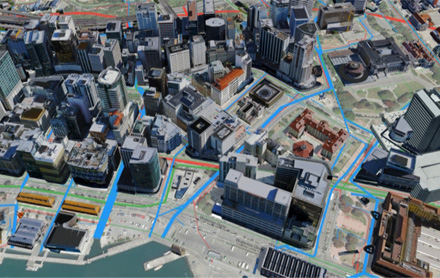
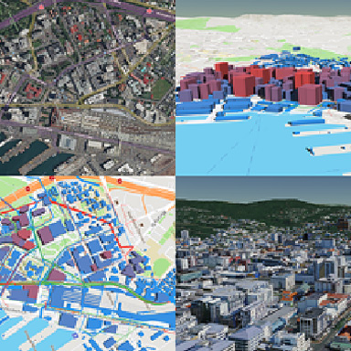
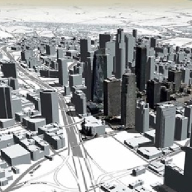
Nextspace is a 3D GIS digital twin and visualization platform.
- Digital twin technology that integrates GIS, CAD, BIM, point cloud, and other 2D/3D data.
- Experience universal user space for visualizing and managing assets and infrastructure.
- Consolidate spatial and non-spatial data into a single view to simplify access, sharing, and integration for all users.
- Nextspace can connect with numerous digital twins across projects, organizations, and cities, allowing him to manage all the data in the world.
- Nextspace – An Ontology Management System for Digital Twins
-

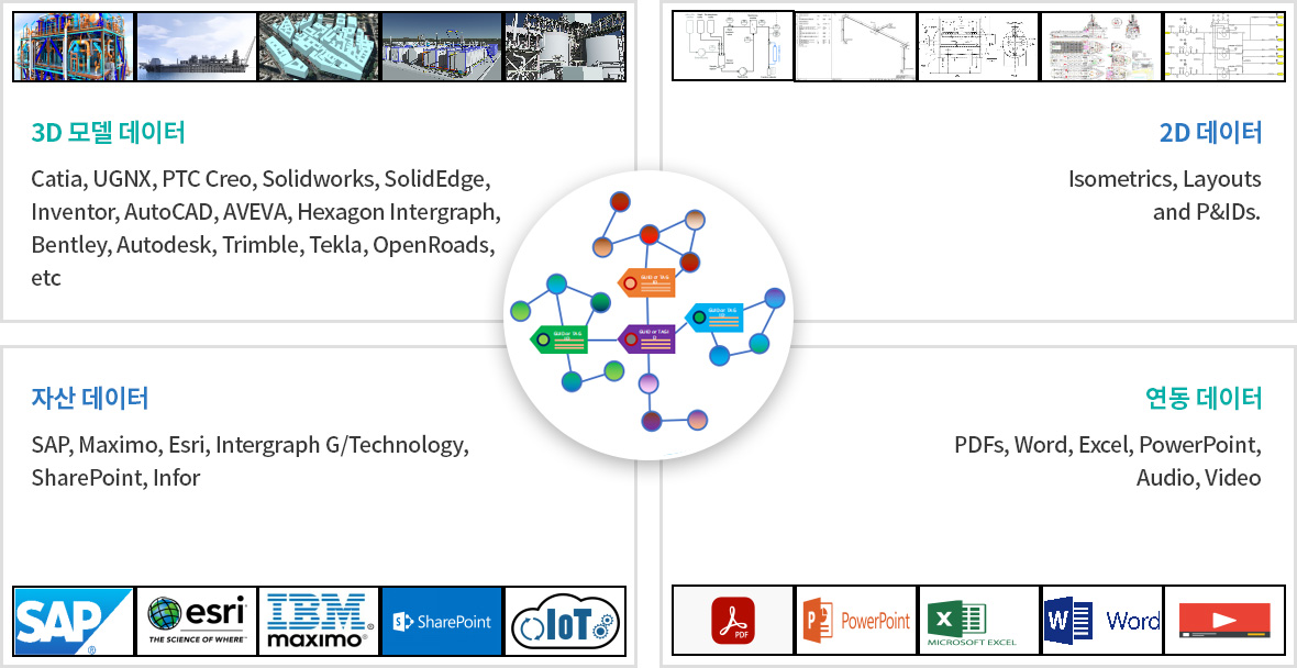
DATA AND THINGS
Nextspace is a tool to manage
data about things (entities) -

DATA ABOUT THINGS
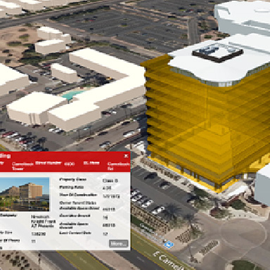
The data about things.
Where / how to access it. -

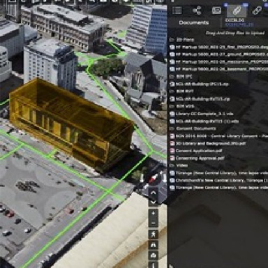
DOCUMENTS AND THINGS
Documents related to
those things -

LOCATION AND THINGS
Where (at any time) and
when those things are -

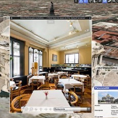
VISUAL PROXIES
Photos, CAD, BIM,
Point Clouds, AR/VR/MR, 2D -

LEVELS OF DETAIL
All different resolutions and
LODs of visual proxies -

RELATIONSHIPS 1
How things are related to
other things and their data -

RELATIONSHIPS 2
Connected to, inside, a
friend of, a parent of, etc.
- Linking and Managing Data
linking and managing data, in multiple visual formats and levels of detail (LODs)
-

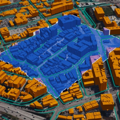
GIS
-

DOCUMENTS
-

CAD
-

ASSETS
-

IoT / SENSORS
-

OTHER DATA
DATA AMALGAMATION FOR YOUR DIGITAL TWIN
Connect and manage all your data through TAG IDs and GUIDs
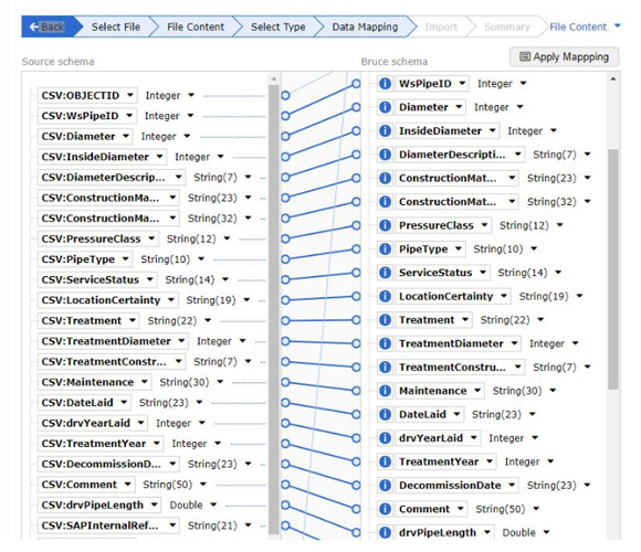
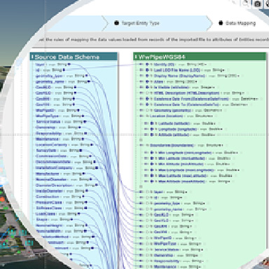
DATA SCHEMA MAPPING TOOLS
-

MANY TO 1 RELATIONSHIPS
Multiple schemas can be set up between imported data and existing entity types.
-

MANY TO MANY RELATIONSHIPS
Multiple schemas can be set up between imported data and existing entity types.
-

NEW SCHEMA FIELDS / ENTITY TYPES
Both can be created on the fly
-

LINK MULTIPLE DATASETS
Values to a single schema and prioritise values
-
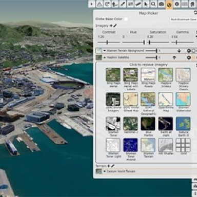
MULTIPLE
BASEMAPS -
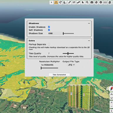
HIGH RES PRINT
-
1-CLICK
3D TO 2D -
SHADOW
ANALYSIS -
3D
VIRTUAL TOURS -
SCHEMA
MAPPING -
3D
STACKING -
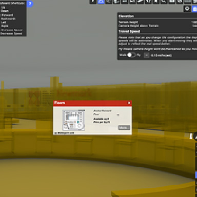
WALK FLY
MODE -
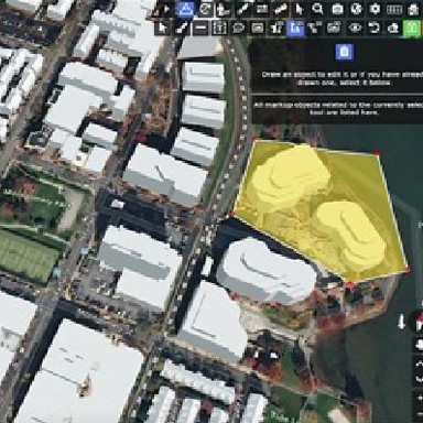
MARK UP
ANNOTATION -
FORM
BUILDER -
ATTACH
FILES -
DOWNLOAD
DATA -
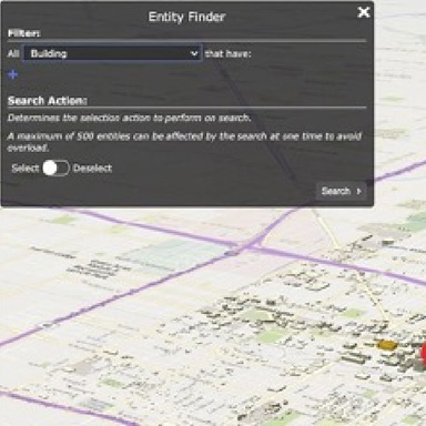
SPATIAL
SEARCH -
BIM /
POINT CLOUDS -
BOOKMARK
SCENES
BRUCE 기본 기능 설명
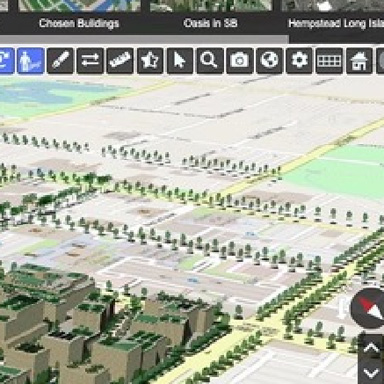
Creating and Editing a terrain Cesium Tile
Find, Link Documents and Media and Visualize
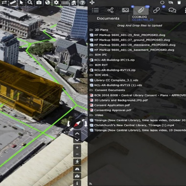
Full spatial and data search
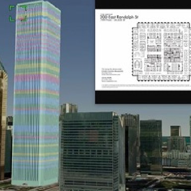
- CAD and BIM models, 3D graphics and data loading.
- Static and dynamic connections to data sources - GIS, IoT, BIM, ERP, etc.
- CRS conversion.
- Get address information location information.
- Mix and match data schemas and merge into an integrated data overview.
- Protection of the original data type.
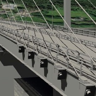
- LIDAR, Reality Meshes, Point Cloud, BIM, CAD, and GIS data merging visual and data.
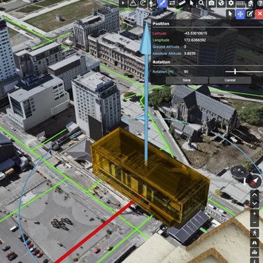
- Position CAD, BIM, GIS, point cloud, and 3D reality mesh data and convert to OGC-compatible Cesium tile sets for maximum online performance.
- Create and edit a terrain Cesium tile set.
Why NEXTSPACE?
-
Web Solution
-
Annual Pricing
-
Intuitive UX
-
Easy of Use
-
Open Platform
-
No Software
-
Low Entry Barrier
-
Fast Production
-
Low-Cost Training
-
Safe Hosting
Nextspace Visualization Engine
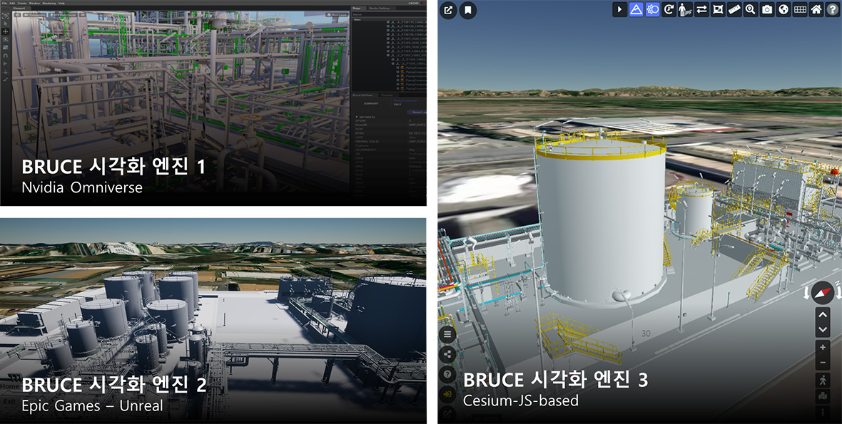
Open Data and Visual System Independence


Nextspace Bruce – Unreal Engine
Introducing Nextspace

RCK Co., LTD. 167, Songpa-daero, Suite A, unit 921, Songpa-gu, Seoul, Republic of Korea TEL : +82-2-575-0877 FAX : +82-2-575-0879
Copyright (c) RCK All rights reserved.